Soar
The World's New Atlas
▼ keep reading ▼
Soar Mission
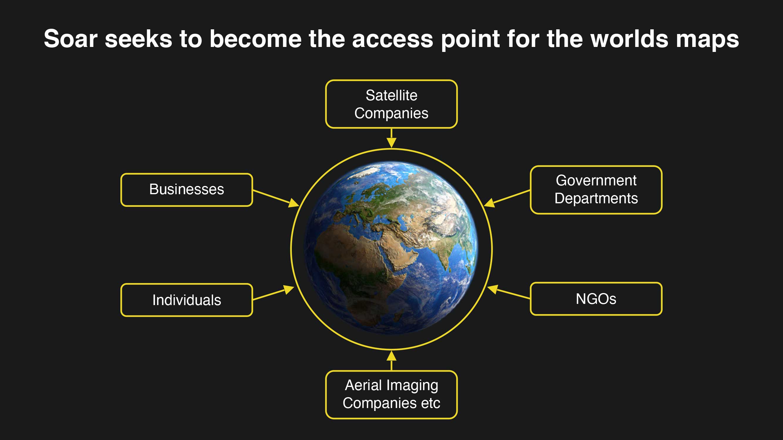
Soar is an Australian early stage company with an ambitious mission, to build the world’s new atlas - a mapping platform bringing together every map, satellite and drone image that has ever existed, or will ever exist, all available in one place.
This ground breaking endeavour marks a pivotal moment in the mapping industry, reminiscent of the transformative impact Google Earth had in 2001. As a result, we are looking for extraordinary partners and investors, because what we are doing isn’t ordinary - to help us build something that is truly intergenerational and of importance to the whole of humanity.
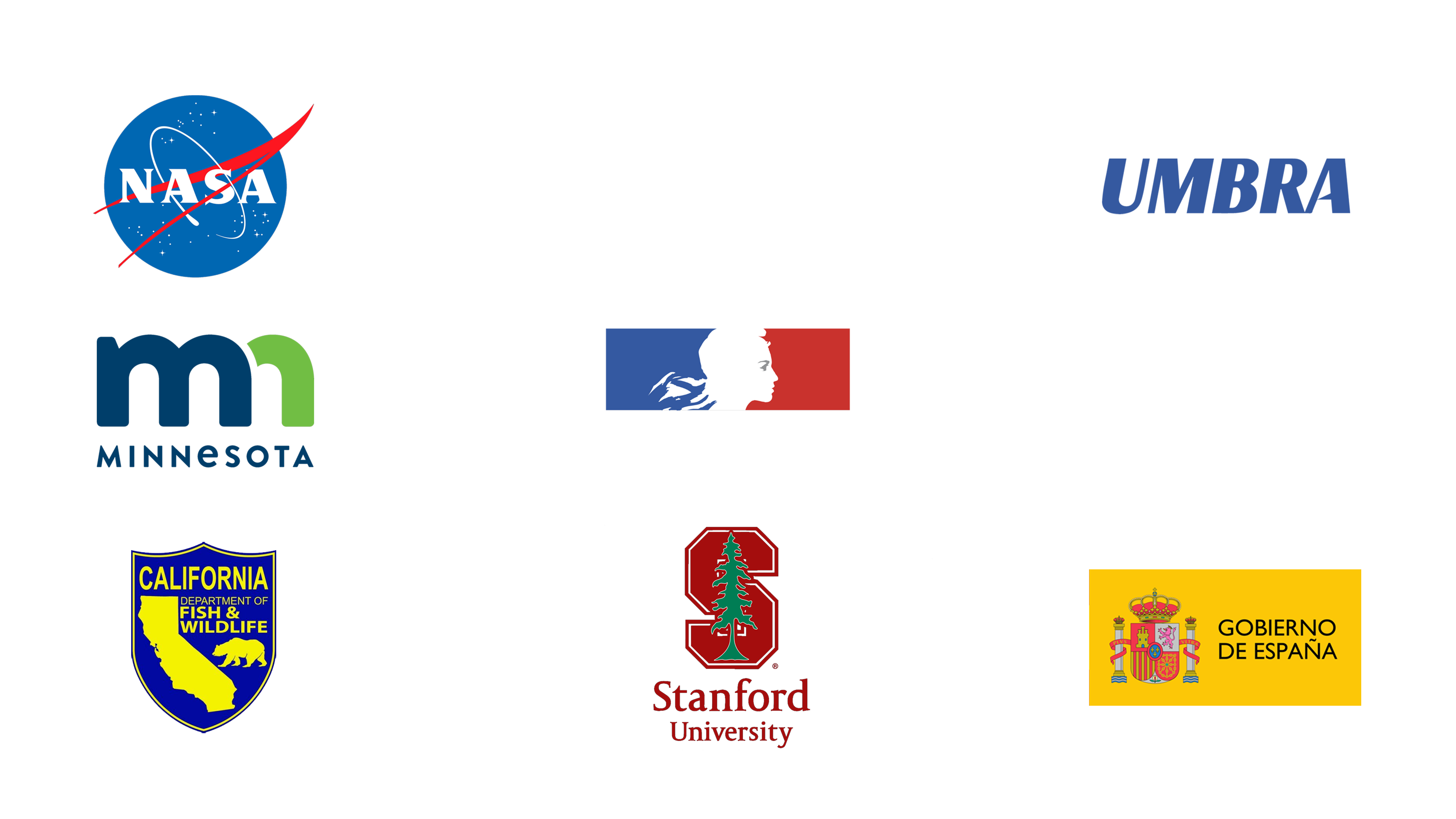
Soar has built a free and easy-to-use mapping platform where users from all over the world can upload and share their maps, as well as access an enormous, ever-growing library of maps, drone, and satellite imagery, and share their content. Users can also access over 640,000 maps uploaded by our ever growing global community of users ranging from NASA satellite feeds, through to geological and topographic maps by Stanford University and the British Library
WHY BUILD THE WORLDS NEW ATLAS AND WHY NOW?
With the release of Google Earth in 2001 and Google Maps in 2005, society and technology embarked on what many thought was the start of the ‘geospatial era’, or so we thought. Since then, we have seen surges in the capability of a range of new technologies such as smart phones, 3G/4G/5G data communications, more satellites, consumer drones, faster internet speed, better technology and access.
So, we must ask - Why hasn’t this one sector evolved dramatically over the last 20 years? The answer is in the structure of how the industry had evolved and adopted innovations with it being held back by:
- Reseller contracts
- Fragmented distribution technology
- Lack of cloud infrastructure
- Poorly built map tiling engines
Now, there is more map data being created daily – in the order of hundreds of terabytes - which is leading to a massive oversupply of data that is now allowing this sector to be disrupted.
The current problem users face is easy access to maps where they are held within silos, making discovery and access difficult for users who are not geospatial experts. These problems can be summarised as:
- 80% of the world’s maps are dispersed across various disconnected channels, posing challenges for their discovery and accessibility.
- Existing repositories such as Google Earth and Bing Maps represent just one type of data.
- Millions of petabytes of maps and imagery are tucked away, hidden between hard drives, closed cloud services as well as sitting on non-interchangeable platforms such as social media.
- Data is often hard to access, only available as prints, are not in a geo-referenced digital format and there is often little or no interoperability.
- Unique, high-quality information is often hidden away and is not discoverable.
Soar solves this problem by bringing together all these maps from all diverse places into a single location to make it easily discoverable for users in a single place.
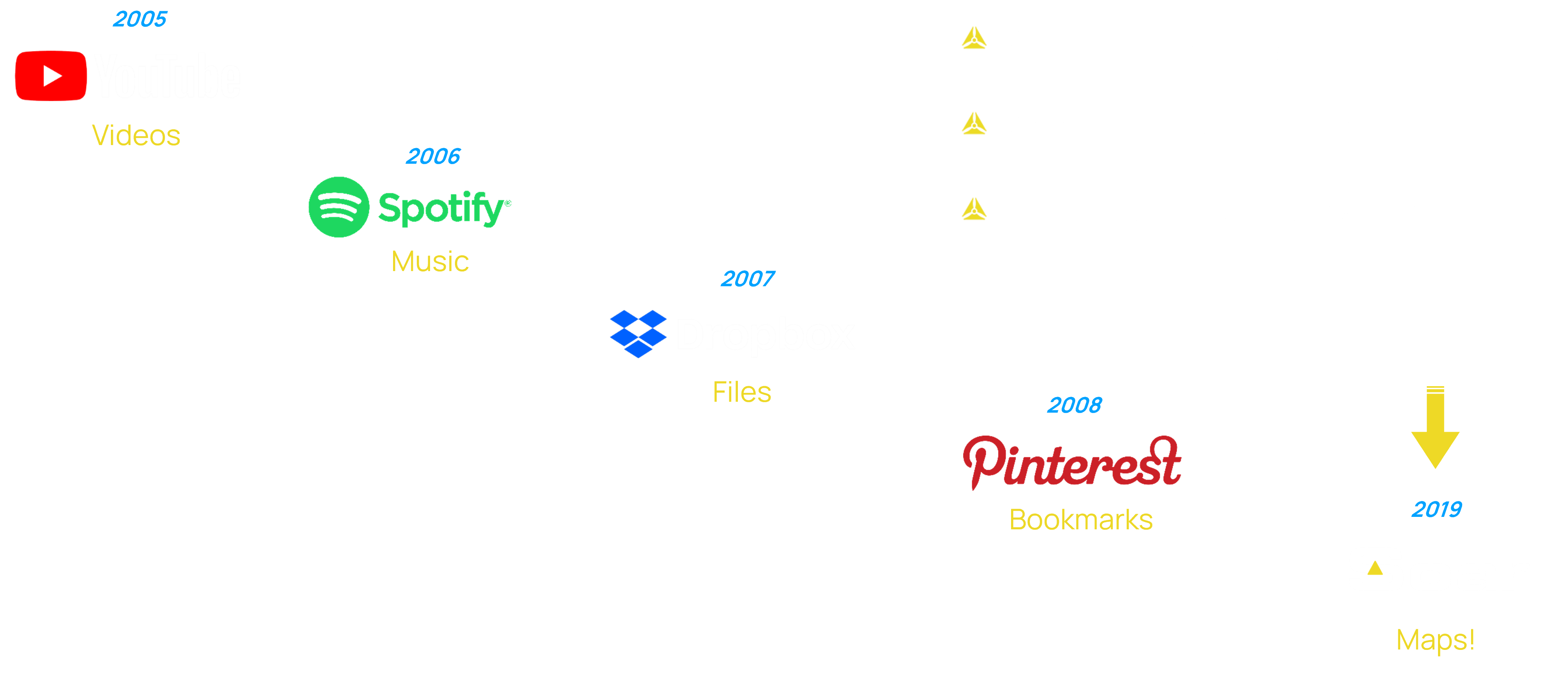
Soar is creating a new category-defining platform for geospatial data ,including all types of maps and imagery. This model has been a successful one for content distribution and sharing in many other markets such as files, video, and music. The graphic below shows the businesses that have positioned themselves to create new market categories and in-turn become ubiquitous.
BUILDING THE DEFINING GENERATIVE AI FOR MAPS
The pivotal element in all generative AI models is access to training data, commonly known as ‘reinforcement learning.’ This stream of data essentially fuels the AI infrastructure crafted by companies such as OpenAI, Google, Anthropic, etc.
Soar is poised to develop the premier generative AI tailored for geospatial applications, leveraging its access to the world’s most extensive map library. As the Soar platform accumulates more mapping data, it not only enhances the intelligence of this AI but also reinforces its competitive advantage, creating a formidable barrier against potential competitors. This, in turn, positions Soar to eventually establish itself as an incumbent in the field.
Maximum Offering
US $10,0000,001.25
Minimum Investment
US $100,001.25
US $10,0000,001.25
Minimum Investment
US $100,001.25
US $100,001.25
terms of the offering
US $10,0000,001.25
Minimum Investment: US $100,001.25 (26,667 shares)
The Company is offering to raise a maximum of 2,666,667 Ordinary Shares at a price of US $3.75 per Share for maximum gross proceeds of US $10,0000,001.25. Prior to this Offering there were 45,805,209 Ordinary Shares issued and outstanding. Upon completion of the Offering between 45,805,209 and 48,471,876 Ordinary Shares will be issued and outstanding. As of the date of this Offering, the Company has certain warrant agreements in place that may impact the number of issued and outstanding shares.
Dividends
Subject to and in accordance with the Corporations Act and to the rights of the holders of any shares created or raised under any special arrangement as to dividend, the Directors may from time to time decide to pay a dividend to the Shareholders entitled to the dividend which shall be payable on all Shares according to the proportion that the amount paid (not credited) is of the total amounts paid and payable (excluding amounts credited) in respect of such Shares. The Directors may rescind a decision to pay a dividend if they decide, before the payment date, that if the Company’s financial position no longer justifies the payment.
The Directors may from time to time pay to the Shareholders any interim dividends that they may determine.
The company does not anticipate paying dividends for the foreseeable future.
Estimated Use of Proceeds
Management Team
The Company is currently managed by seasoned business and sector professionals dedicated to the success of the Company and efficient execution of its planned operations.

Amir
Farhand
Amir Farhand
Chief Executive Officer
Amir is the CEO and Founder of Soar. In the past 15 years, Amir has combined information technology in the fields of source coding, application design, system management and in-stream business operations to commercialise several high-profile mapping systems. These systems have gone onto to be used in applications ranging from mining, engineering, agriculture and military. Amir has also written and co-authored several internationally recognized technical papers in the field of geospatial technology and mapping systems and their influence in commercial applications in multiple sectors. Several of these papers have gone on to be awarded by the International Remote Sensing Conference (Australia, China and USA) in their ability to assist with geological and geomorphological analysis, particularly with using RADAR algorithms for mineral exploration in tropical regions. Since 2015, Amir has been working closely with mapping and geospatial technologies in bringing mapping to the masses using existing systems such as satellites and drones.

Neil
Prentice
Neil Prentice
Chief Operating Officer
Neil has had a diverse career with over 28 years’ experience with roles involving manufacturing businesses, technical and market research, management, consulting and strategy. During this time, he has worked with many organisations assisting them in assessing innovative, technology-based business opportunities and bringing these to the market.
Neil has been working with Soar since 2018 assisting the CEO in internal operations, business development and seeking government funding opportunities and took up the role as COO in December 2019.

Chris
Lowe
Chris Lowe
Chief Technology Officer
Chris has led the development of software at Soar for the past 10 years and has delivered high-quality software products from inception through to completion. Chris has been extensively involved in the development of the Mappt mobile mapping platform as was the lead developer for Mappt Military, the precursor product on which the Soar platform is based. As the CTO, Chris has been the driving force behind the technical development of both Mappt and the Soar platform.

Marek
Tlacbaba
Marek Tlacbaba
Head of Engineering
Marek holds a Master’s Degree at Faculty of Informatics from Masaryk University and commenced his career in the Czech Republic as java developer focusing on JavaEE backend systems. In 2014 he moved to Australia and started to work at Soar and was involved in the development of Mappt and Mappt Military. He was responsible for developing various prototypes using serverless architecture for backend and ReactJS for client applications. In 2019, he took over the role as Head of Engineering has participated in all aspects of Soar's back-end development and cloud operations which includes project architecture, team development, resource assignment and project estimation.

Guy
Perkins
Guy Perkins
Non-Executive Director
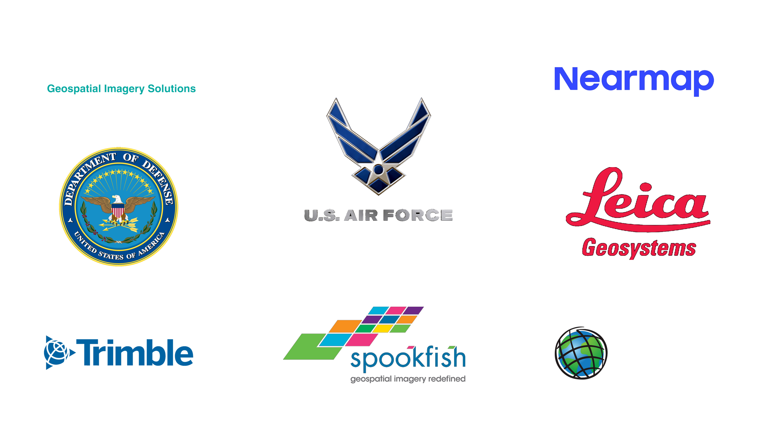
Guy has over 25 years’ experience in the global geospatial industry including in several key management positions. He has worked with global leaders in geospatial technologies such as ESRI, MapInfo, ER Mapper, Hexagon, 1Spatial and was a co-founder of both NearMap (ASX: NEA), and Spookfish Ltd (ASX: SFI). He was also the Managing Director of Connexion Telematics (ASX: CVX) from August 2019 to June 2020.
Guy is a civil engineer (UWA) with extensive business know-how and geospatial industry knowledge. Guy is an active participant in the geospatial industry community and was a founding director of the Australian Spatial Information Business Association (SIBA). He was a member of the Research Investment Review Board of the Cooperative Research Centre – Spatial Information (CRC–SI) and served on other industry advisory bodies.
CONTACT US
Please complete the contact form and we will get back to you about any questions you have about our offering.
Soar.Earth Ltd – Suite 3, 128 Main Street Osborne Park, Western Australia, Australia 6017 Attn: Neil Prentice — neil@soar.earth — +61 414 522 226
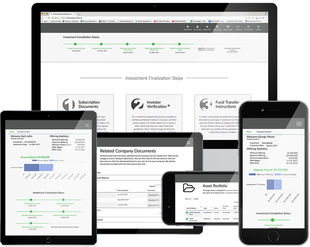
so much more than what you see
The Soar.Earth Ltd. Investor Portal provides the ability to learn about our investment opportunity. Once registered, you will be able to:
- Access to the Private Placement Memorandum, which outlines our company and gives greater detail about our offering;
- Access to our SEC filing;
- View real time offering metrics of how far along we are in the offering process;
- View a timeline of your progress in the subscription process;
- View company contact information - directly contact us with any questions;
- Easily upgrade your account with the click of a button to go through the subscription process.
Once your account is upgraded you will have additional tools including the ability to:
- Complete the subscription documents;
- Upload accreditation documents if applicable;
- Access instructions on transfer of investment funds;
- Access company documents including Reports, Financials, and Supporting Documents;
- Access the Asset Portfolio as applicable;
- View News articles written by the company;
- View and download documents associated with your account.